 Xining is the capital of Qinghai province in western China, and the largest city on the Qinghai-Tibet Plateau. It has 2,208,708 inhabitants at the 2010 census whom 1,198,304 live in the built up area made of 4 urban districts.
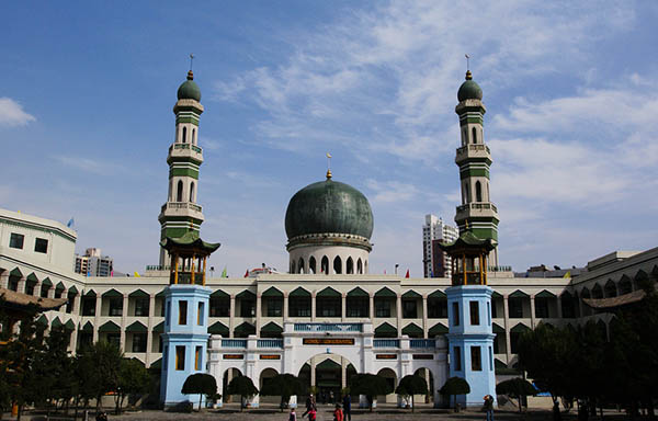
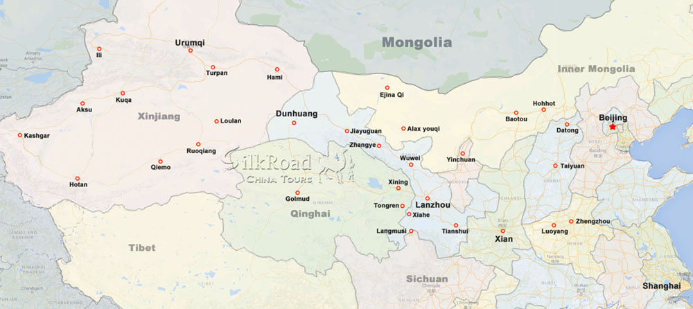
The city was a commercial hub along the Northern Silk Road's Hexi Corridor for over 2000 years, and was a stronghold of the Han, Sui, Tang, and Song dynasties' resistance against nomadic attacks from the west. Although long a part of Gansu province, Xining was added to Qinghai in 1928. Xining holds sites of religious significance to Muslims and Buddhists, including the Dongguan Mosque and Ta'er Monastery. The city lies in the Huangshui River valley, and owing to its high altitude, has a cold semi-arid climate. It is connected by rail to Lhasa, Tibet and Lanzhou, Gansu.
Xining has a history of over 2100 years and was a chief commercial hub on the Hexi Corridor caravan route to Tibet, handling especially timber, wool and salt in ancient times. The trade along the Hexi Corridor was part of a larger trade corridor along the Northern Silk Road, whose use was intensified in the 1st century BC after efforts by the Han Dynasty to control this route.
Under the Han dynasty (206 BC–220 AD) a county there called Linqiang controlled the local Qiang tribesmen. It was again a frontier county under the Sui (581–618) and Tang (618–907) dynasties; during the 7th and early 8th centuries it was a center of constant warfare with the Tuyuhun and (later) the Tibetan peoples. In 763, it was overrun by the Tibetans and while under Tibetan control was known to the Chinese as Qingtangcheng. Recovered by the Song dynasty in 1104, it received the name Xining (meaning "peace in the west") and has been the seat of a prefecture or superior prefecture under that name since that time. In the late 16th century, the Ta'er Monastery was founded some 19 km (12 mi) to the southeast, establishing Xining as an important religious center for the Yellow Hat sect of Buddhists.
A major earthquake occurred May 22, 1927 and measured 8.6 on Richter scale. It was one of the deadliest earthquakes with a total count of 200,000 deaths. It also caused large land fractures.
Xining was the extraterritorial capital of the Koko Nor territory and remained in Gansu until 1928, when it became the provincial capital of the newly established independent province of Qinghai. Xining was given municipal status in 1945.
Under Governor 1928's reign, Xining, like the rest of Qinghai, underwent industrialization and modernization. In 1947 the USA sold Ma Bufang a piped water (sewage) system which was installed in Xining. Ma Bufang also promoted education. He made businessmen methodically clean up Xining by serving as insect exterminators, killing flies and neatly throwing them away.
Since the late 1950s, when the Liujia Gorge Dam and hydroelectric project came into operation in neighboring Gansu province, Xining has been linked by a high-tension electrical grid to both Liujia and Lanzhou. It also uses local coal from mines at Datongxian to the north. A modern woolen mill was installed at Xining before 1957. The city also has a leather industry and is a market for salt from the Qaidam region. During the late 1950s medium-sized iron and steelworks were built there, supplying metal to Lanzhou.
Construction of a highway to the mineral-rich Qaidam basin and completion in 1959 a link to the Chinese rail network via Lanzhou in Gansu province has spurred industrial development. This effort was part of a plan of the central government to rapidly exploit oil and pasturage in the Xining area beginning in the 1950s.
Xining is located in the eastern part of Qinghai Province and lies on the Huangshui River. It has a total area of 350 km2 (140 sq mi).[dubious – discuss]
Xining is located on the eastern edge of the Qinghai-Tibet Plateau and the upper reaches of the Huangshui River. It is the political, economic, and cultural center of Qinghai Province with an average altitude of about 2,200 metres (7,200 ft). Human activity in the region can be traced to 2,100 years ago. During the Western and Eastern Han dynasties, owing to its developing agriculture, Xining was paid noticed due to its economic and military significance. As well as being an important hinge between the Central Plains and the western part of China in ancient times, Xining was an important link in the Silk Road. It continues to be an important rail and road link to the hinterlands of the Qinghai-Tibet Plateau.
Xining has also been dubbed the Summer Resort Capital of China owing to its cool summer, with a cold semi-arid climate (Köppen BSk). Conditions are influenced by the aridity and high altitude. Nights are cold or cool throughout the year, and the diurnal temperature variation often reaches or exceeds 15 °C (27 °F). The monthly 24-hour average temperatures ranges from −7.4 °C (18.7 °F) in January to 17.3 °C (63.1 °F) in July; the annual mean is 6.10 °C (43.0 °F). Rainfall falls mainly from May to September, and the area is often dry and sunny, with 2,676 hours of bright sunshine per year.
Weather

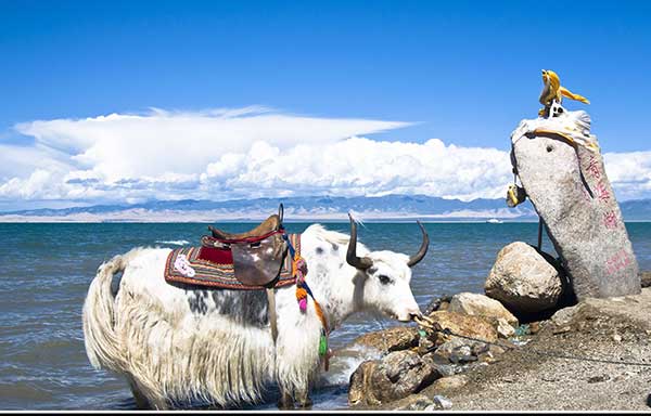
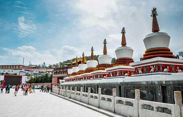
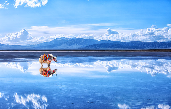
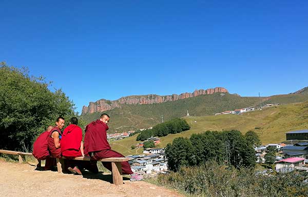
Attractions in Xining


General Information
Alias: Cool City
Area: 7649 sq km
Location: Qinghai
Airport: 28 km from city
Train Station: In urban area
Population: 2,208,000
Map
Relevant blogs
-
How did the name of Tianshui in Gansu come about?
The name Tianshui is very pleasant to the ear, and it reminds one of that exquisitely beautiful verse, "After getting drunk, one doesn't know if the sky is in
-
The 8th Silk Road Hotel Festival was successfully
On December 27th, the "8th Silk Road Hotel Festival" grandly opened at the Yujing International Hotel in Zhangye. This hotel festival gathered industry experts,
-
The Karez Irrigation System in Turpan has been sel
On September 3rd, at the 75th Executive Council Meeting of the International Commission on Irrigation and Drainage held in Sydney, Australia, the 2024 (11th bat
-
What is the connection between "dragons" and "s
In traditional Chinese culture, the snake has a dual identity of auspiciousness and danger. Ancient people believed that the snake not only possesses divine cha
-
Endangered Przewalski's Horses Spotted at Dunhuan
<p>In early February, a group of special "visitors"—the Przewalski's horses—appeared at the Dunhuang Yumen Pass scenic area in Gansu Province, a U
-
The Fourth Dunhuang Cultural Tourism Supplier Conf
On the morning of February 18th, the Fourth Dunhuang Cultural Tourism Supplier Conference in Northwest China commenced at the Dunhuang International Convention
Tags
Silk Road China Tours -
Reliable travel agency based in Dunhuang, China. We focus on providing customized tours across Silk Road in China,on your own terms and with reasonable prices.
Contact Us
Gansu, China
Phone: 0086 - 18919428669 (24h)
Tel: 0086 - 937 - 8809499 (24h)
Email: Service@silkroadtourcn.com
2005 © All Rights Reserved. Privacy & Security | Terms & Conditions